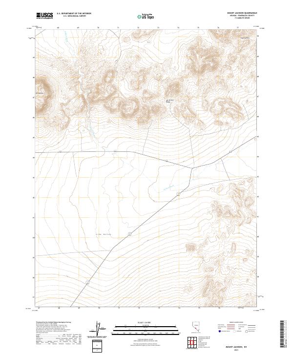
2021 Map of Mount Jackson
USGS Topo · Published 2021About this map
Mt Jackson and its surrounding ridge dominate this high-desert landscape in Esmeralda County. The terrain transitions from the steep, contoured slopes of Mt Jackson Ridge in the north down into the broad expanse of Lida Valley. This 2021 topographic survey highlights the drainage patterns of Jackson Wash, which cuts a path across the central valley floor. In the northeast corner, the Cuprite Hills rise above the basin, while the corridor for Route 266 provides the primary transit route through this arid Nevada region. The map provides a clear look at the Public Land Survey System grid, including boundaries for t5s r41.5e and t6s r42e, essential for modern land-use research and locating specific sections of this high-elevation desert.
Find a feature on this map
10 named features on this map. Tap any name to fly to it.
Don’t see what you’re looking for? This feature index may not catch every label — zoom into the map to look around manually.
Map Details
Editions of this 2021 Mount Jackson Map
This is the sole edition of this map. No revisions or reprints were ever made.
Other maps of this area

1908 · Lida
USGS Topo · 1:250,000

1913 · Lida
USGS Topo · 1:250,000

1945 · Goldfield
USGS Topo · 1:125,000

1952 · Goldfield
USGS Topo · 1:62,500

1954 · Goldfield
USGS Topo · 1:250,000

1955 · Goldfield
USGS Topo · 1:250,000

1958 · Goldfield
USGS Topo · 1:250,000

1962 · Goldfield
USGS Topo · 1:250,000

1968 · Lida
USGS Topo · 1:24,000

1968 · Stonewall Pass
USGS Topo · 1:24,000