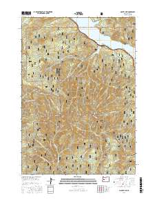
2017 Map of Mount June
USGS Topo · Published 2017About this map
Mount June and Hardesty Mtn anchor this high-elevation landscape where the Willamette National Forest meets the Umpqua National Forest. The map documents a complex network of forest development roads, including Nat Forest Develop Road 504 Rd and Nat For Dev Rd 1721, which traverse the steep ridges and drainages. The northern reaches are defined by the shoreline of Lookout Point Lake, while prominent geographical landmarks like Eagles Rest and Sawtooth Rock provide orientation across the mountainous terrain.
Find a feature on this map
47 named features on this map. Tap any name to fly to it.
Don’t see what you’re looking for? This feature index may not catch every label — zoom into the map to look around manually.
Map Details
Editions of this 2017 Mount June Map
This is the sole edition of this map. No revisions or reprints were ever made.
Other maps of this area

1935 · Lowell
USGS Topo · 1:96,000

1942 · Lowell
USGS Topo · 1:125,000

1955 · Hardesty Mtn
USGS Topo · 1:62,500

1955 · Fairview Peak
USGS Topo · 1:62,500

1955 · Culp Creek
USGS Topo · 1:62,500

1955 · Lowell
USGS Topo · 1:62,500

1958 · Roseburg
USGS Topo · 1:250,000

1959 · Roseburg
USGS Topo · 1:250,000

1983 · Oakridge
USGS Topo · 1:100,000
1986 · Saddleblanket Mountain
USGS Topo · 1:24,000