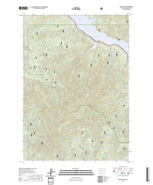
2024 Map of Mount June
USGS Topo · Published 2024About this map
The Willamette National Forest and Umpqua National Forest converge in this high-elevation region of the Cascade Range. Dominated by the waters of the Middle Fork Willamette River and the northern reaches of Lookout Point Lake, the landscape is a network of ridges and drainage basins. High points like Mt June, Hardesty Mtn, and Patterson Mtn anchor the terrain, connected by an extensive system of established paths including the Hardesty Way Trl and the Eugene-To-Pacific Crest Trl. This modern survey illustrates the current management of these public lands, showing the intersection of vital timber resources and recreation routes like the Eula Ridge Trl and the NATL Forest Develop Road 512 RD that provide access through the dense forest canopy.
Find a feature on this map
44 named features on this map. Tap any name to fly to it.
Don’t see what you’re looking for? This feature index may not catch every label — zoom into the map to look around manually.
Map Details
Editions of this 2024 Mount June Map
This is the sole edition of this map. No revisions or reprints were ever made.
Other maps of this area

1935 · Lowell
USGS Topo · 1:96,000

1942 · Lowell
USGS Topo · 1:125,000

1955 · Hardesty Mtn
USGS Topo · 1:62,500

1955 · Fairview Peak
USGS Topo · 1:62,500

1955 · Culp Creek
USGS Topo · 1:62,500

1955 · Lowell
USGS Topo · 1:62,500

1958 · Roseburg
USGS Topo · 1:250,000

1959 · Roseburg
USGS Topo · 1:250,000

1983 · Oakridge
USGS Topo · 1:100,000
1986 · Saddleblanket Mountain
USGS Topo · 1:24,000