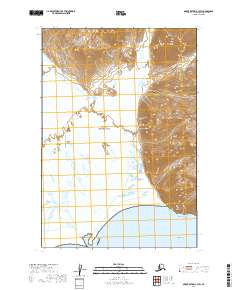
2019 Map of Mount Katmai A-3 SW
USGS Topo · Published 2019About this map
Katmai National Park encompasses this coastal Alaskan landscape, where the glacially-fed Katmai River and Soluka Creek drain through the wide Katmai Valley toward the Gulf of Alaska. The terrain is defined by dramatic elevation changes, rising from the tidal flats of Katmai Bay to the high peaks of the Barrier Range and the distinctive Painted Mtn. The hydrology shown here reveals the shifting alluvial nature of the river delta before it meets the sea near Katmai Rock. This map documents a wilderness area where the natural drainage patterns and mountain topography remain the dominant features, largely untouched by permanent human settlement or modern infrastructure. The absence of roads or established trails highlights the preserve's character as a managed natural environment within the Lake and Peninsula region.
Find a feature on this map
12 named features on this map. Tap any name to fly to it.
Don’t see what you’re looking for? This feature index may not catch every label — zoom into the map to look around manually.
Map Details
Editions of this 2019 Mount Katmai A-3 SW Map
This is the sole edition of this map. No revisions or reprints were ever made.
Other maps of this area

1948 · Mt Katmai
USGS Topo · 1:250,000

1951 · Mt Katmai
USGS Topo · 1:250,000

1951 · Karluk
USGS Topo · 1:250,000

1951 · Mount Katmai A-3
USGS Topo · 1:63,360

1951 · Karluk D-4
USGS Topo · 1:63,360

1951 · Mount Katmai A-4
USGS Topo · 1:63,360

1952 · Karluk
USGS Topo · 1:250,000

1964 · Mt. Katmai
USGS Topo · 1:250,000

1964 · Karluk
USGS Topo · 1:250,000
2019 · Mount Katmai A-3 NE
USGS Topo · 1:25,000