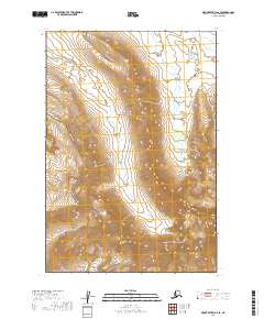
2019 Map of Mount Katmai A-6 SE
USGS Topo · Published 2019About this map
Katmai National Park and the Becharof National Wildlife Refuge meet in this remote stretch of the Alaska Peninsula, where the landscape is defined by the dramatic elevations of the Kejulik Mountains. This 2019 survey captures a transition between protected federal lands during a period of modern topographical mapping. The terrain is characterized by steep contours and isolated drainage systems like Takayoto Cr in the northeast corner. Because the area lacks established roads or settlements, the map focuses on the natural topography and the administrative boundaries of the Public Land Survey System, including t24s r39w and t25s r40w, which provide essential reference points for navigating this wild interior.
Find a feature on this map
8 named features on this map. Tap any name to fly to it.
Don’t see what you’re looking for? This feature index may not catch every label — zoom into the map to look around manually.
Map Details
Editions of this 2019 Mount Katmai A-6 SE Map
This is the sole edition of this map. No revisions or reprints were ever made.
Other maps of this area

1948 · Mt Katmai
USGS Topo · 1:250,000

1951 · Mt Katmai
USGS Topo · 1:250,000

1951 · Karluk
USGS Topo · 1:250,000

1951 · Mount Katmai A-6
USGS Topo · 1:63,360

1951 · Karluk D-6
USGS Topo · 1:63,360

1951 · Karluk D-5
USGS Topo · 1:63,360

1951 · Mount Katmai A-5
USGS Topo · 1:63,360

1952 · Karluk
USGS Topo · 1:250,000

1964 · Mt. Katmai
USGS Topo · 1:250,000

1964 · Karluk
USGS Topo · 1:250,000