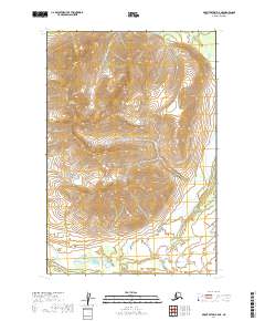
2019 Map of Mount Katmai B-5 NE
USGS Topo · Published 2019About this map
Mt Katolinat dominates the northwestern portion of this 2019 survey, looking down upon a landscape shaped by volcanic history within Katmai National Park. The southern portion of the map captures the transition into the Valley of Ten Thousand Smokes, where the Valley Of Ten Thousand Smokes Road and Ukak Falls Trail provide the only established routes through the drainage systems of the Ukak River and River Lethe. The topography here reflects the massive deposition of ash and ignimbrite from the 1912 eruption, creating the broad, flat valley floors seen along the southern margin. To the west, Margot Cr cuts through the higher elevations, highlighting the complex drainage patterns that continue to carve through this geologically active terrain. This map serves as a detailed record of the wilderness boundary and the access points to one of the most significant volcanic sites in North America.
Find a feature on this map
14 named features on this map. Tap any name to fly to it.
Don’t see what you’re looking for? This feature index may not catch every label — zoom into the map to look around manually.
Map Details
Editions of this 2019 Mount Katmai B-5 NE Map
This is the sole edition of this map. No revisions or reprints were ever made.
Other maps of this area

1948 · Mt Katmai
USGS Topo · 1:250,000

1951 · Mt Katmai
USGS Topo · 1:250,000

1951 · Mount Katmai B-4
USGS Topo · 1:63,360

1951 · Mount Katmai C-5
USGS Topo · 1:63,360

1951 · Mount Katmai C-4
USGS Topo · 1:63,360

1951 · Mount Katmai B-5
USGS Topo · 1:63,360
1953 · Mount Katmai B-5
USGS Topo · 1:63,360
1953 · Mount Katmai C-5
USGS Topo · 1:63,360

1964 · Mt. Katmai
USGS Topo · 1:250,000
2019 · Mount Katmai C-5 SW
USGS Topo · 1:25,000