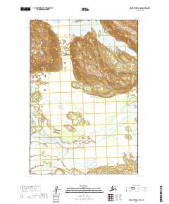
2019 Map of Mount Katmai C-4 SW
USGS Topo · Published 2019About this map
Katmai National Park encompasses this terrain in the Alaska Peninsula, where the landscape is defined by the convergence of significant glacial and volcanic waterways. The Savonoski River flows through the eastern portion of the sheet, carving through a broad valley before meeting the northern reaches of Naknek Lake. To the south, the Ukak River and the meandering Ikaqluik Creek feed into this complex hydrographic system. The map reveals the dramatic topographical contrast between the high ridges of the Aleutian Range and the sediment-filled basins of the river deltas, illustrating the ongoing geological processes within this protected wilderness. This 2019 survey provides a precise record of the shoreline and drainage patterns as they existed in the early 21st century.
Find a feature on this map
9 named features on this map. Tap any name to fly to it.
Don’t see what you’re looking for? This feature index may not catch every label — zoom into the map to look around manually.
Map Details
Editions of this 2019 Mount Katmai C-4 SW Map
This is the sole edition of this map. No revisions or reprints were ever made.
Other maps of this area

1948 · Mt Katmai
USGS Topo · 1:250,000

1951 · Mt Katmai
USGS Topo · 1:250,000

1951 · Mount Katmai B-4
USGS Topo · 1:63,360

1951 · Mount Katmai C-5
USGS Topo · 1:63,360

1951 · Mount Katmai C-4
USGS Topo · 1:63,360

1951 · Mount Katmai B-5
USGS Topo · 1:63,360
1953 · Mount Katmai B-5
USGS Topo · 1:63,360
1953 · Mount Katmai C-5
USGS Topo · 1:63,360

1964 · Mt. Katmai
USGS Topo · 1:250,000
2019 · Mount Katmai B-4 NE
USGS Topo · 1:25,000