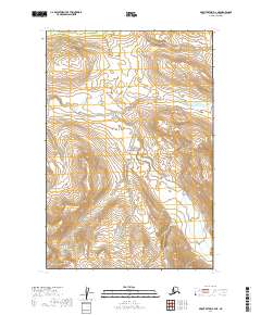
2019 Map of Mount Katmai B-4 NE
USGS Topo · Published 2019About this map
Katmai National Park encompasses the majority of this landscape, dominated by high-altitude glacial terrain and dramatic drainage basins. In the southwest corner, the peak of Mt Juhle rises above a series of steep contour lines that illustrate the elevation changes characteristic of the Aleutian Range. The primary drainage system is defined by Ikagluik Creek, also labeled as Ikagluik Cr, which winds through the central valley floors. This 2019 survey documents the hydrologic patterns and glacial topography within the Lake and Peninsula Borough, showing a wilderness area devoid of permanent human settlements or road infrastructure. The map serves as a record of the precise environmental state of this protected volcanic region in the early 21st century.
Find a feature on this map
10 named features on this map. Tap any name to fly to it.
Don’t see what you’re looking for? This feature index may not catch every label — zoom into the map to look around manually.
Map Details
Editions of this 2019 Mount Katmai B-4 NE Map
This is the sole edition of this map. No revisions or reprints were ever made.
Other maps of this area

1948 · Mt Katmai
USGS Topo · 1:250,000

1951 · Mt Katmai
USGS Topo · 1:250,000

1951 · Mount Katmai C-3
USGS Topo · 1:63,360

1951 · Mount Katmai B-4
USGS Topo · 1:63,360

1951 · Mount Katmai C-4
USGS Topo · 1:63,360

1951 · Mount Katmai B-3
USGS Topo · 1:63,360

1964 · Mt. Katmai
USGS Topo · 1:250,000
2019 · Mount Katmai C-4 SW
USGS Topo · 1:25,000
2019 · Mount Katmai C-4 SE
USGS Topo · 1:25,000
2019 · Mount Katmai B-4 SW
USGS Topo · 1:25,000