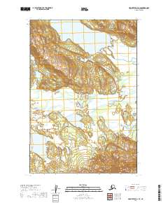
2019 Map of Mount Katmai C-4 SE
USGS Topo · Published 2019About this map
Katmai National Park encompasses this entire stretch of the Alaska Peninsula, where glacial waters and high-altitude terrain define the landscape. The northern portion of the map is dominated by the expanse of Lake Grosvenor, which feeds into a network of drainages including American Creek and Hardscrabble Creek. These water systems are critical components of the local ecosystem, providing a look at the hydrologic patterns within the park boundaries.
Find a feature on this map
9 named features on this map. Tap any name to fly to it.
Don’t see what you’re looking for? This feature index may not catch every label — zoom into the map to look around manually.
Map Details
Editions of this 2019 Mount Katmai C-4 SE Map
This is the sole edition of this map. No revisions or reprints were ever made.
Other maps of this area

1948 · Mt Katmai
USGS Topo · 1:250,000

1951 · Mt Katmai
USGS Topo · 1:250,000

1951 · Mount Katmai C-3
USGS Topo · 1:63,360

1951 · Mount Katmai B-4
USGS Topo · 1:63,360

1951 · Mount Katmai C-4
USGS Topo · 1:63,360

1951 · Mount Katmai B-3
USGS Topo · 1:63,360

1964 · Mt. Katmai
USGS Topo · 1:250,000
2019 · Mount Katmai C-4 SW
USGS Topo · 1:25,000
2019 · Mount Katmai B-4 NE
USGS Topo · 1:25,000
2019 · Mount Katmai C-3 NW
USGS Topo · 1:25,000