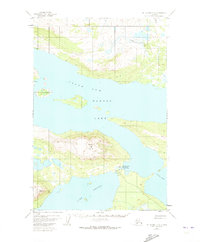
1951 Map of Mount Katmai C-6
USGS Topo · Published 1973About this map
North Arm Naknek Lake and the surrounding wilderness of the Katmai National Monument are depicted here as they were documented in the early 1950s. The landscape is defined by its deep glacial waters and prominent peaks, notably Dumpling Mountain, which overlooks the convergence of Brooks Lake and the larger Naknek system. The presence of the Brooks Camp Ranger Station Seaplane Base underscores the region's reliance on aviation for access and administration in the post-war era. Along the Brooks R, the map identifies the location of Brooks Falls, a site historically significant for its wildlife and fisheries. Small clusters of Cabins and unidentified Ruins suggest a landscape where temporary habitation and administrative outposts were the only footprints in an otherwise wild terrain. The survey provides a clear view of the complex shoreline including the Iliuk Arm.
Find a feature on this map
9 named features on this map. Tap any name to fly to it.
Don’t see what you’re looking for? This feature index may not catch every label — zoom into the map to look around manually.
Map Details
Editions of this 1951 Mount Katmai C-6 Map
3 editions found
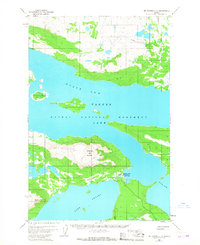
Other maps of this area

1948 · Mt Katmai
USGS Topo · 1:250,000

1951 · Mt Katmai
USGS Topo · 1:250,000

1951 · Mount Katmai C-6
USGS Topo · 1:63,360

1951 · Mount Katmai B-6
USGS Topo · 1:63,360

1951 · Naknek D-1
USGS Topo · 1:63,360

1951 · Naknek B-1
USGS Topo · 1:63,360

1951 · Mount Katmai D-5
USGS Topo · 1:63,360

1951 · Naknek C-1
USGS Topo · 1:63,360

1951 · Mount Katmai C-5
USGS Topo · 1:63,360

1951 · Mount Katmai D-6
USGS Topo · 1:63,360