
1951 Map of Naknek D-1
USGS Topo · Published 1956About this map
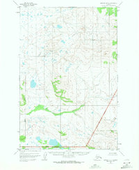
King Salmon Creek winds through this subarctic terrain during the early 1950s, representing a landscape largely untouched by modern development. This 1:63,360 scale survey focuses on the wilderness northwest of the Valley of Ten Thousand Smokes, highlighting the Katmai National Monument Boundary (Approximate) as it existed before the expansion of the modern park system. The map reveals a complex network of glacial ponds, small lakes, and tributary drainage patterns typical of the Alaska Peninsula. While human settlements are absent from this specific quadrangle, the precise topographical data recorded by the Geological Survey and USCE provides an essential record of the natural hydrology and elevation of the Katmai National Monument region during a period of significant aerial mapping in the territory.
Find a feature on this map
3 named features on this map. Tap any name to fly to it.
Don’t see what you’re looking for? This feature index may not catch every label — zoom into the map to look around manually.
Map Details
Editions of this 1951 Naknek D-1 Map
2 editions found
Other maps of this area

1948 · Mt Katmai
USGS Topo · 1:250,000

1951 · Dillingham
USGS Topo · 1:250,000

1951 · Mt Katmai
USGS Topo · 1:250,000

1951 · Mount Katmai C-6
USGS Topo · 1:63,360

1951 · Naknek C-1
USGS Topo · 1:63,360

1951 · Mount Katmai D-6
USGS Topo · 1:63,360

1951 · Iliamna A-8
USGS Topo · 1:63,360

1951 · Dillingham A-1
USGS Topo · 1:63,360

1952 · Iliamna
USGS Topo · 1:250,000

1952 · Naknek
USGS Topo · 1:250,000