
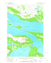
1951 Map of Mount Katmai C-6
USGS Topo · Published 1956About this map
Katmai National Monument is defined by the expansive waters of North Arm Naknek Lake and the prominent heights of Dumpling Mountain. This 1951 survey, based on early aerial photography, illustrates a rugged landscape where hydrology and terrain dictate human presence. Near the narrow channel connecting Brooks Lake to the Iliuk Arm, small clusters of activity are noted by the presence of Cabins and a Dam near Brooks Falls. The inclusion of Cabins (Abandon) and ancient Ruins suggest a history of seasonal or temporary habitation in this remote territory. The map serves as a vital record of the monument's topography before significant modern development, focusing on natural landmarks and isolated structural footprints.
Find a feature on this map
10 named features on this map. Tap any name to fly to it.
Don’t see what you’re looking for? This feature index may not catch every label — zoom into the map to look around manually.
Map Details
Editions of this 1951 Mount Katmai C-6 Map
3 editions found
Other maps of this area

1948 · Mt Katmai
USGS Topo · 1:250,000

1951 · Mt Katmai
USGS Topo · 1:250,000

1951 · Mount Katmai B-6
USGS Topo · 1:63,360

1951 · Naknek D-1
USGS Topo · 1:63,360

1951 · Naknek B-1
USGS Topo · 1:63,360

1951 · Mount Katmai D-5
USGS Topo · 1:63,360

1951 · Naknek C-1
USGS Topo · 1:63,360

1951 · Mount Katmai C-5
USGS Topo · 1:63,360

1951 · Mount Katmai D-6
USGS Topo · 1:63,360

1951 · Mount Katmai B-5
USGS Topo · 1:63,360