
1951 Map of Dillingham A-1
USGS Topo · Published 1956About this map
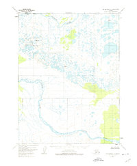
The Kvichak River and Alagnak River dominate this 1950s landscape, flowing through a complex network of wetlands and tundra in the Alaska-Third Judicial Division. This map, based on 1951 aerial photography, illustrates a largely unsettled wilderness where water governs the geography. A single Cabin near the northern river bend represents the only named structure in the quadrangle, serving as a vital landmark for those navigating these remote waterways. The terrain is marked by survey control points such as Vabm Yenuk 408 and Vabm Statem 361, which provided the essential data for the U.S. Geological Survey to map this intricate drainage system. The braid of the rivers and the density of unnamed ponds reflect the shifting, hydraulic nature of the Bristol Bay region during the mid-century.
Find a feature on this map
6 named features on this map. Tap any name to fly to it.
Don’t see what you’re looking for? This feature index may not catch every label — zoom into the map to look around manually.
Map Details
Editions of this 1951 Dillingham A-1 Map
4 editions found
Other maps of this area

1948 · Mt Katmai
USGS Topo · 1:250,000

1951 · Dillingham
USGS Topo · 1:250,000

1951 · Mt Katmai
USGS Topo · 1:250,000

1951 · Naknek D-1
USGS Topo · 1:63,360

1951 · Mount Katmai D-6
USGS Topo · 1:63,360

1951 · Iliamna A-8
USGS Topo · 1:63,360

1952 · Iliamna
USGS Topo · 1:250,000

1952 · Naknek
USGS Topo · 1:250,000

1952 · Dillingham A-2
USGS Topo · 1:63,360

1952 · Naknek D-2
USGS Topo · 1:63,360