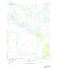
1951 Map of Dillingham A-1
USGS Topo · Published 1983About this map
The Kvichak River and Alagnak River dominate this 1951 landscape, weaving through a complex network of wetlands and small lakes in southwest Alaska. The terrain is characterized by low-lying tundra and expansive marshlands, with occasional elevations marked by triangulation stations such as Vabm 408 Yenuk, Vabm 361 Statem, and Vabm 197 Naku. These peaks serve as critical reference points in an otherwise fluid and shifting environment.
Find a feature on this map
10 named features on this map. Tap any name to fly to it.
Don’t see what you’re looking for? This feature index may not catch every label — zoom into the map to look around manually.
Map Details
Editions of this 1951 Dillingham A-1 Map
4 editions found
Other maps of this area

1948 · Mt Katmai
USGS Topo · 1:250,000

1951 · Dillingham
USGS Topo · 1:250,000

1951 · Mt Katmai
USGS Topo · 1:250,000

1951 · Naknek D-1
USGS Topo · 1:63,360

1951 · Mount Katmai D-6
USGS Topo · 1:63,360

1951 · Iliamna A-8
USGS Topo · 1:63,360

1951 · Dillingham A-1
USGS Topo · 1:63,360

1952 · Iliamna
USGS Topo · 1:250,000

1952 · Naknek
USGS Topo · 1:250,000

1952 · Dillingham A-2
USGS Topo · 1:63,360