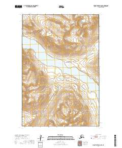
2019 Map of Mount Katmai D-3 NW
USGS Topo · Published 2019About this map
Katmai National Park encompasses this entire sub-arctic landscape, where high-altitude ridges drop sharply toward the central waters of Kulik Lake. This 2019 survey captures the wilderness character of the Lake and Peninsula Borough during a period of modern glacial and hydrological monitoring. The map's topographic detail shows the intricate drainage patterns feeding into the lake, reflecting a landscape shaped by significant volcanic and glacial activity. Defined by the Public Land Survey System boundaries of t14s r34w and t15s r34w, the area remains an undeveloped preserve dedicated to the protection of the region's unique ecosystems and freshwater resources.
Find a feature on this map
6 named features on this map. Tap any name to fly to it.
Don’t see what you’re looking for? This feature index may not catch every label — zoom into the map to look around manually.
Map Details
Editions of this 2019 Mount Katmai D-3 NW Map
This is the sole edition of this map. No revisions or reprints were ever made.
Other maps of this area

1948 · Mt Katmai
USGS Topo · 1:250,000

1951 · Mt Katmai
USGS Topo · 1:250,000

1951 · Iliamna A-5
USGS Topo · 1:63,360

1951 · Mount Katmai D-4
USGS Topo · 1:63,360

1951 · Mount Katmai D-3
USGS Topo · 1:63,360

1951 · Iliamna A-6
USGS Topo · 1:63,360

1952 · Iliamna
USGS Topo · 1:250,000

1952 · Iliamna A-5
USGS Topo · 1:63,360

1957 · Iliamna
USGS Topo · 1:250,000

1964 · Mt. Katmai
USGS Topo · 1:250,000