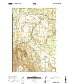
2019 Map of Mount Katmai D-6 NE
USGS Topo · Published 2019About this map
The boundary between the Katmai National Preserve and the Katmai National Park cuts across this 2019 survey, delineating different levels of protection and management within the Alaskan wilderness. The terrain is defined by extreme relief and glacial-cut valleys, where dramatic elevation changes are documented through detailed contour lines. This specific area within the Lake and Peninsula Borough illustrates the intersection of conservation zones and public land systems, marked by the PLSS townships of t14s r39w, t14s r38w, t15s r39w, and t15s r38w. The absence of roads or permanent settlements highlights the wilderness character of these federal lands, emphasizing a landscape shaped by natural drainage patterns and topographical features rather than human infrastructure.
Find a feature on this map
6 named features on this map. Tap any name to fly to it.
Don’t see what you’re looking for? This feature index may not catch every label — zoom into the map to look around manually.
Map Details
Editions of this 2019 Mount Katmai D-6 NE Map
This is the sole edition of this map. No revisions or reprints were ever made.
Other maps of this area

1948 · Mt Katmai
USGS Topo · 1:250,000

1951 · Mt Katmai
USGS Topo · 1:250,000

1951 · Mount Katmai D-5
USGS Topo · 1:63,360

1951 · Mount Katmai D-6
USGS Topo · 1:63,360

1951 · Iliamna A-8
USGS Topo · 1:63,360

1952 · Iliamna
USGS Topo · 1:250,000
1952 · Iliamna A-8
USGS Topo · 1:63,360

1957 · Iliamna
USGS Topo · 1:250,000

1964 · Mt. Katmai
USGS Topo · 1:250,000
2019 · Mount Katmai D-6 SE
USGS Topo · 1:25,000