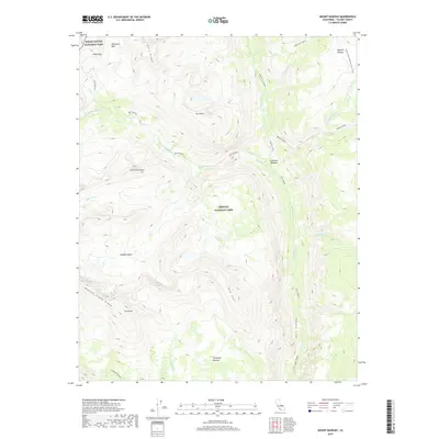
2018 Map of Mount Kaweah
USGS Topo · Published 2018About this map
Sequoia National Park and Kings Canyon National Park meet in this high-altitude landscape dominated by the Great Western Divide. The towering summit of Mt Kaweah anchors the southern portion of the map, rising above the Kaweah Basin and the dramatic Kaweah Peaks Ridge. This area represents a critical watershed where the Kern Kaweah River and Kern River carve deep glacial troughs, most notably at the steep-walled Kern Canyon. The drainage patterns of Tyndall Cr, Wallace Creek, and Whitney Cr illustrate the complex alpine topography that defines the Sierra Nevada crest. For those studying the history of wilderness travel, the map traces the Pacific Crest National Scenic Trail as it traverses the Bighorn Plateau, alongside the historic path of the John Dean Cutoff. Further south, the broad Chagoopa Plateau provides a distinct geographical contrast to the sharp ridges of Red Spur and Kern Ridge.
Find a feature on this map
31 named features on this map. Tap any name to fly to it.
Don’t see what you’re looking for? This feature index may not catch every label — zoom into the map to look around manually.
Map Details
Editions of this 2018 Mount Kaweah Map
This is the sole edition of this map. No revisions or reprints were ever made.
Other maps of this area

1903 · Tehipite
USGS Topo · 1:125,000

1904 · Kaweah
USGS Topo · 1:125,000

1905 · Tehipite
USGS Topo · 1:125,000

1905 · Olancha
USGS Topo · 1:125,000

1907 · Olancha
USGS Topo · 1:125,000

1907 · Mt. Whitney
USGS Topo · 1:125,000

1909 · Kaweah
USGS Topo · 1:125,000

1919 · Mt. Whitney
USGS Topo · 1:125,000

1937 · Mt. Whitney
USGS Topo · 1:125,000

1937 · Kaweah
USGS Topo · 1:125,000