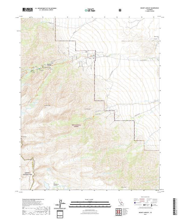
2021 Map of Mount Langley
USGS Topo · Published 2021About this map
Whitney Portal stands as a primary gateway to the high peaks of the Sierra Nevada, serving as a critical transition point between the lowlands and the alpine wilderness. The landscape is defined by massive elevation changes, moving from the floor of the Owens Valley up toward the formidable summits of Mt Langley and Mt Corcoran. This area is a network of drainage and ascent, with Lone Pine Creek and Tuttle Creek carving through the granite slopes. High-altitude hydrology is a central feature here, evidenced by the cluster of alpine basins containing Cottonwood Lakes, Meysan Lake, and the smaller Peanut Lake. Evidence of spiritual and recreational history is etched into the terrain via the Tuttle Creek Ashram Trail and the Mount Whitney Trail, while the inclusion of Movie Flat in the northeast corner alludes to the region's long-standing connection to the film industry.
Find a feature on this map
44 named features on this map. Tap any name to fly to it.
Don’t see what you’re looking for? This feature index may not catch every label — zoom into the map to look around manually.
Map Details
Editions of this 2021 Mount Langley Map
This is the sole edition of this map. No revisions or reprints were ever made.
Other maps of this area

1905 · Olancha
USGS Topo · 1:125,000

1907 · Olancha
USGS Topo · 1:125,000

1907 · Mt. Whitney
USGS Topo · 1:125,000

1919 · Mt. Whitney
USGS Topo · 1:125,000

1937 · Mt. Whitney
USGS Topo · 1:125,000

1948 · Fresno
USGS Topo · 1:250,000

1955 · Fresno
USGS Topo · 1:250,000

1956 · Fresno
USGS Topo · 1:250,000

1956 · Mount Whitney
USGS Topo · 1:62,500

1956 · Olancha
USGS Topo · 1:62,500