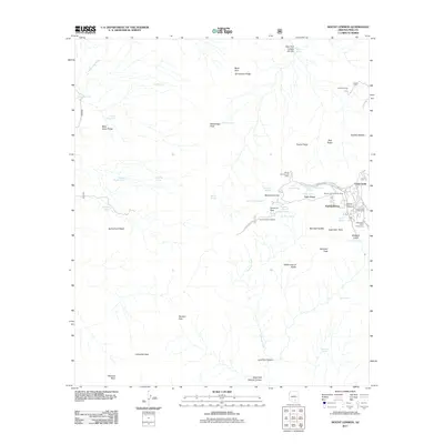
2011 Map of Mount Lemmon
USGS Topo · Published 2011About this map
Mount Lemmon and the mountain community of Summerhaven define this high-elevation landscape in the Santa Catalina Mountains. The map illustrates a developed recreation and residential hub centered around the Mount Lemmon Post Office and the Mount Lemmon Ski Valley, where narrow winding routes like Turkey Run Rd and Turkey St provide access to the village. The presence of the Lemmon Rock Lookout and the Loma Linda Picnic Area underscores the area's long-standing role as a mountain retreat and fire observation point.
Find a feature on this map
60 named features on this map. Tap any name to fly to it.
Don’t see what you’re looking for? This feature index may not catch every label — zoom into the map to look around manually.
Map Details
Editions of this 2011 Mount Lemmon Map
This is the sole edition of this map. No revisions or reprints were ever made.
Other maps of this area
1904 · Tucson
USGS Topo · 1:125,000
1905 · Tucson
USGS Topo · 1:125,000
1911 · Winkelman
USGS Topo · 1:125,000
1913 · Winkelman
USGS Topo · 1:125,000
1948 · Mammoth
USGS Topo · 1:62,500
1948 · Campo Bonito
USGS Topo · 1:24,000
1949 · Campo Bonito
USGS Topo · 1:24,000
1951 · Mammoth
USGS Topo · 1:62,500

1956 · Tucson
USGS Topo · 1:250,000
1957 · Bellota Ranch
USGS Topo · 1:62,500