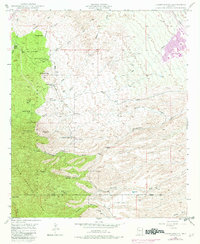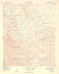
1949 Map of Campo Bonito
USGS Topo · Published 1949About this map
Mining claims and cattle ranches define this high-elevation landscape within the Coronado National Forest during the late 1940s. The northern reaches of the Santa Catalina Mts are marked by a cluster of workings including the Southern Belle Mine, Highjinks Mine, and Bonito Mine, reflecting the region's hard-rock extraction history. A centralized Smelter sits near the head of Smelter Wash, indicating the processing infrastructure required for these remote mountain operations. Settlement is largely concentrated in family-held ranch lands, such as the Kannally Ranch and American Flag Ranch, which utilize the area's natural drainages. These ranches were vital outposts along the Mt Lemon Road, serving as markers for travelers navigating between Rice Peak and the deep cuts of Peppersauce Wash. The topography transitions from the high ridges of Oracle Ridge down into the complex drainage systems of Big Bonito Canyon and Stratton Canyon.
Find a feature on this map
38 named features on this map. Tap any name to fly to it.
Don’t see what you’re looking for? This feature index may not catch every label — zoom into the map to look around manually.
Map Details
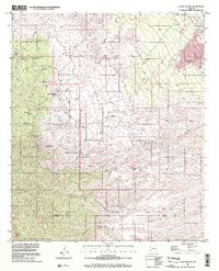
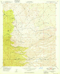
Editions of this 1949 Campo Bonito Map
2 editions found
Historical Maps of San Manuel Through Time
7 maps found