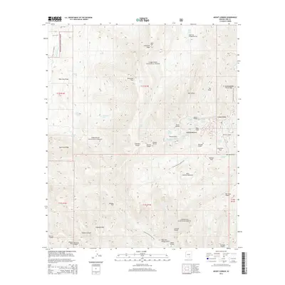
2014 Map of Mount Lemmon
USGS Topo · Published 2014About this map
Summerhaven and the high-elevation community of Loma Linda serve as the primary human settlements in this high-altitude portion of the Coronado National Forest. Centered on the summit of Mount Lemmon, the landscape is defined by its dramatic verticality, where prominent ridges like Samaniego Ridge and Radio Ridge divide deep drainage systems such as Lemmon Canyon and Esperero Canyon. The presence of numerous named springs, including Barkley Spring and Dead Pine Spring, indicates the critical role of water sources for both local flora and the historical use of these peaks.
Find a feature on this map
70 named features on this map. Tap any name to fly to it.
Don’t see what you’re looking for? This feature index may not catch every label — zoom into the map to look around manually.
Map Details
Editions of this 2014 Mount Lemmon Map
This is the sole edition of this map. No revisions or reprints were ever made.
Other maps of this area

1904 · Tucson
USGS Topo · 1:125,000

1905 · Tucson
USGS Topo · 1:125,000

1911 · Winkelman
USGS Topo · 1:125,000

1913 · Winkelman
USGS Topo · 1:125,000

1948 · Mammoth
USGS Topo · 1:62,500

1948 · Campo Bonito
USGS Topo · 1:24,000

1949 · Campo Bonito
USGS Topo · 1:24,000
1951 · Mammoth
USGS Topo · 1:62,500

1956 · Tucson
USGS Topo · 1:250,000

1957 · Bellota Ranch
USGS Topo · 1:62,500