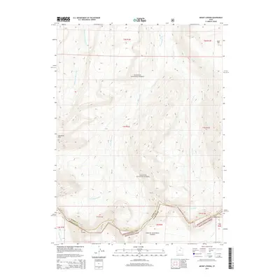
2014 Map of Mount Lovenia
USGS Topo · Published 2014About this map
Mount Lovenia stands as the prominent landmark of this high-elevation landscape, where the administrative boundaries of the Wasatch National Forest and Ashley National Forest converge. This 2014 survey documents a complex hydrological system defined by the headwaters of several major waterways, including the Middle Fork Blacks Fork, E Fork Blacks Fork, and Little E Fork. These drainage patterns illustrate the natural divide along the Uinta Mountains, where water flows northward toward the Blacks Fork and southward via the Lake Fork River and Oweep Cr. The topographic detail highlights notable high-altitude crossings like Squaw Pass and jagged summits such as Tokewanna Peak and Bald Mtn. Spanning the border of Summit Co and Duchesne Co, the map illustrates a protected wilderness environment devoid of permanent settlements, focused instead on the natural features that define the Utah backcountry.
Find a feature on this map
13 named features on this map. Tap any name to fly to it.
Don’t see what you’re looking for? This feature index may not catch every label — zoom into the map to look around manually.
Map Details
Editions of this 2014 Mount Lovenia Map
This is the sole edition of this map. No revisions or reprints were ever made.
Other maps of this area

1885 · Uinta
USGS Topo · 1:250,000

1901 · Hayden Peak
USGS Topo · 1:125,000

1903 · Hayden Peak
USGS Topo · 1:125,000

1905 · Gilbert Peak
USGS Topo · 1:125,000

1906 · Gilbert Peak
USGS Topo · 1:125,000

1954 · Salt Lake City
USGS Topo · 1:250,000

1958 · Salt Lake City
USGS Topo · 1:250,000

1960 · Salt Lake City
USGS Topo · 1:250,000

1967 · Explorer Peak
USGS Topo · 1:24,000
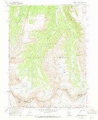
1967 · Mount Lovenia
USGS Topo · 1:24,000