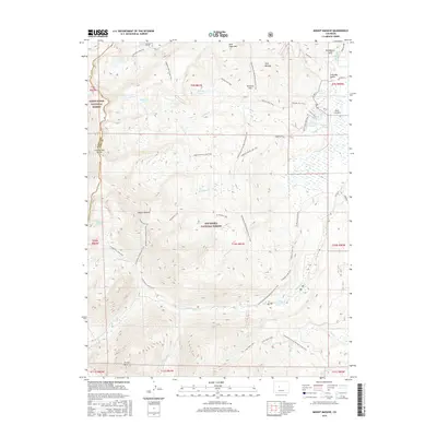
2016 Map of Mount Massive
USGS Topo · Published 2016About this map
Mount Massive dominates this high-altitude landscape along the border of White River National Forest and San Isabel National Forest. The map documents a complex network of alpine hydrology and engineering, including the Ivanhoe Tunnel and irrigation infrastructure like Dunn Ditch near Soda Springs. The geography is defined by the Continental Divide as it splits Pitkin and Lake counties, with water draining through steep drainages like Halfmoon Cr and Rock Cr. Numerous high-elevation water bodies are clustered throughout the terrain, including Windsor Lake, Emerald Lake, and the N Halfmoon Lakes. The human footprint is marked by an extensive trail system, including the Continental Divide National Scenic Trail and the Mt Massive Trail, providing a clear record of the access routes used to navigate these summits and remote parks like Kearney Park.
Find a feature on this map
63 named features on this map. Tap any name to fly to it.
Don’t see what you’re looking for? This feature index may not catch every label — zoom into the map to look around manually.
Map Details
Editions of this 2016 Mount Massive Map
This is the sole edition of this map. No revisions or reprints were ever made.
Other maps of this area

1889 · Leadville
USGS Topo · 1:125,000

1891 · Leadville
USGS Topo · 1:125,000

1909 · Mount Jackson
USGS Topo · 1:125,000

1911 · Mount Jackson
USGS Topo · 1:125,000

1935 · Mount Elbert
USGS Topo · 1:62,500

1938 · Mount Elbert
USGS Topo · 1:62,500

1939 · Mount Elbert
USGS Topo · 1:62,500

1942 · Leadville
USGS Topo · 1:125,000

1949 · Holy Cross
USGS Topo · 1:62,500

1951 · Holy Cross
USGS Topo · 1:62,500