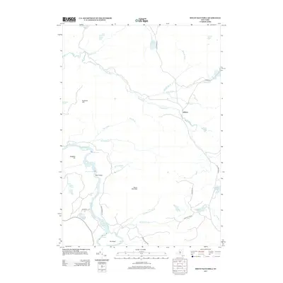
2013 Map of Mount Matumbla
USGS Topo · Published 2013About this map
The settlement of Kildare anchors a landscape defined by an intricate network of waterways and low-lying Adirondack terrain in the early 21st century. The Jordan River winds through the center of the sheet, eventually meeting the Raquette River which flows past Hedgehog Hill and through several whitewater sections including Hedgehog Rapids, Burnt Island Rapids, and Sols Rapids. These natural features emphasize the importance of the river corridor for seasonal transit and recreation.
Find a feature on this map
36 named features on this map. Tap any name to fly to it.
Don’t see what you’re looking for? This feature index may not catch every label — zoom into the map to look around manually.
Map Details
Editions of this 2013 Mount Matumbla Map
This is the sole edition of this map. No revisions or reprints were ever made.
Other maps of this area

1904 · Long Lake
USGS Topo · 1:62,500

1905 · Saint Regis
USGS Topo · 1:62,500

1907 · Tupper Lake
USGS Topo · 1:62,500

1920 · Childwold
USGS Topo · 1:62,500

1921 · Childwold
USGS Topo · 1:48,000

1922 · Childwold
USGS Topo · 1:62,500

1948 · Ogdensburg
USGS Topo · 1:250,000

1951 · Ogdensburg
USGS Topo · 1:250,000

1953 · Ogdensburg
USGS Topo · 1:250,000

1954 · Tupper Lake
USGS Topo · 1:62,500