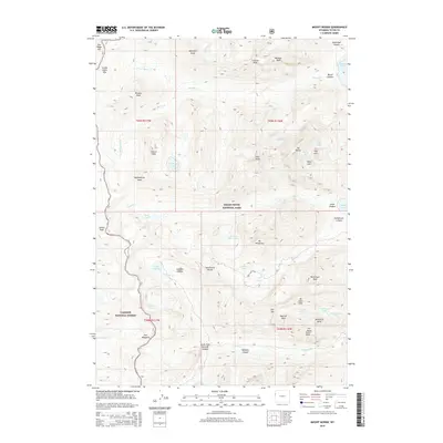
2015 Map of Mount Moran
USGS Topo · Published 2015About this map
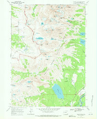
Mt Moran dominates the northeast quadrant of this landscape, surrounded by high-altitude glacial features like the Triple Glaciers and Falling Ice Glacier. The terrain transition is sharp, descending from the granite peaks of the Grand Teton National Park down through deep glacial troughs including Cascade Canyon and Leigh Canyon. Water is a defining element here, with numerous high-country basins holding Lake Solitude, Mica Lake, and Holly Lake. The survey details a network of drainage systems, including the N Fork Moran Cr and S Fork Moran Cr, which feed toward Jackson Lake just beyond the eastern boundary. This edition provides a record of the wilderness boundary between the national park and the adjacent Targhee National Forest to the west, along the Dry Ridge Mtn and Green Lakes Mtn crest.
Find a feature on this map
58 named features on this map. Tap any name to fly to it.
Don’t see what you’re looking for? This feature index may not catch every label — zoom into the map to look around manually.
Map Details
Editions of this 2015 Mount Moran Map
This is the sole edition of this map. No revisions or reprints were ever made.
Other maps of this area

1899 · Grand Teton
USGS Topo · 1:125,000

1901 · Grand Teton
USGS Topo · 1:125,000

1955 · Driggs
USGS Topo · 1:250,000

1958 · Driggs
USGS Topo · 1:250,000

1962 · Driggs
USGS Topo · 1:250,000
1968 · Granite Basin
USGS Topo · 1:24,000

1968 · Moose
USGS Topo · 1:24,000
1968 · Ranger Peak
USGS Topo · 1:24,000
1968 · Rammel Mountain
USGS Topo · 1:24,000
1968 · Grand Teton
USGS Topo · 1:24,000