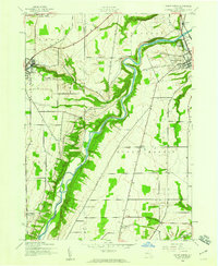
1943 Map of Mount Morris
USGS Topo · Published 1960About this map
The Genesee River cuts a deep, winding path through this 1943 landscape, forming a dramatic natural boundary between the townships of Leicester, Perry, Mount Morris, and Castile. Mapped by the Army Map Service during the early 1940s, the terrain shows a transition from the structured street grid of Mount Morris and the edge of Perry to the dispersed rural crossroads that define the region's agricultural character. Small settlements such as Simmons Corners, Ridge, and Brooks Grove appear as vital local hubs connected by a network of unimproved dirt and secondary roads. In the southeast, the Pennsylvania railroad line follows the course of Keshequa Cr, highlighting the importance of the river valleys for mid-century transportation. Notable water features like the Silver Lake Outlet and Buck Run Creek drain into the main river channel, illustrating the complex drainage patterns of the Wyoming and Livingston County border area.
Find a feature on this map
20 named features on this map. Tap any name to fly to it.
Don’t see what you’re looking for? This feature index may not catch every label — zoom into the map to look around manually.
Map Details
Editions of this 1943 Mount Morris Map
2 editions found
Other maps of this area

1904 · Batavia
USGS Topo · 1:62,500

1904 · Caledonia
USGS Topo · 1:62,500

1905 · Portage
USGS Topo · 1:62,500

1905 · Nunda
USGS Topo · 1:62,500

1943 · Mount Morris
USGS Topo · 1:24,000

1943 · Sonyea
USGS Topo · 1:24,000

1943 · Nunda
USGS Topo · 1:24,000

1943 · Ossian
USGS Topo · 1:24,000

1943 · Castile
USGS Topo · 1:24,000

1943 · Portageville
USGS Topo · 1:24,000