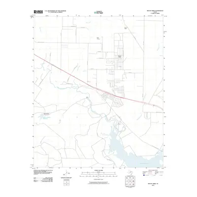
2010 Map of Mount Nebo
USGS Topo · Published 2010About this map
The Grape Creek settlement and its surrounding ranchland define this West Texas landscape just north of San Angelo. Established on the high ground north of the North Concho River, the community is anchored by the Grape Creek Cemetery and a residential grid that has expanded significantly by the early 21st century. The map highlights the area's transition from open ranching country, evidenced by the Brown Ranch, to a more developed suburban fringe connected by the Old Sterling City Hwy and several farm-to-market routes.
Find a feature on this map
34 named features on this map. Tap any name to fly to it.
Don’t see what you’re looking for? This feature index may not catch every label — zoom into the map to look around manually.
Map Details
Editions of this 2010 Mount Nebo Map
This is the sole edition of this map. No revisions or reprints were ever made.
Other maps of this area

1891 · Hayrick
USGS Topo · 1:125,000

1892 · San Angelo
USGS Topo · 1:125,000

1894 · Hayrick
USGS Topo · 1:125,000

1895 · Sherwood
USGS Topo · 1:125,000

1924 · San Angelo 2-b
USGS Topo · 1:48,000

1924 · Sherwood 1-a
USGS Topo · 1:48,000

1928 · Wall
USGS Topo · 1:62,500

1928 · Tankersly
USGS Topo · 1:62,500

1954 · San Angelo
USGS Topo · 1:250,000

1957 · Carlsbad
USGS Topo · 1:62,500