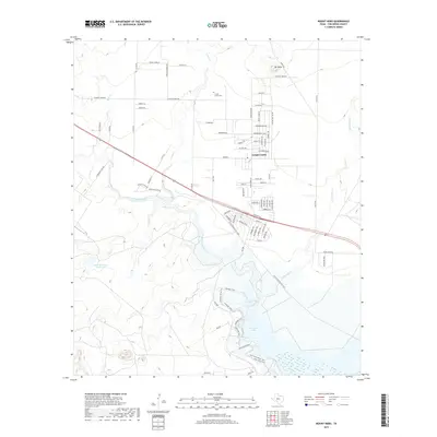
2019 Map of Mount Nebo
USGS Topo · Published 2019About this map
Grape Creek serves as a central hub in this Tom Green County landscape, where residential development meets the sprawling northern reaches of the North Concho River. The settlement's street grid is heavily themed around nature, with names like Orchid Ave, Larkspur Ave, and Zinnia Ave defining its eastern residential blocks. To the north, the terrain rises toward the prominent landmark of Mt Nebo, overlooking the intersection of Grape Creek and several rural roads such as W Grape Creek Rd. To the south, the landscape is dominated by water and recreation, where the North Concho River flows into O C Fisher Lake. Genealogists and local historians can find the Grape Creek Cem positioned near the water, while the Kenneth Brown Reservoir provides an additional water management feature to the west of the main river channel.
Find a feature on this map
81 named features on this map. Tap any name to fly to it.
Don’t see what you’re looking for? This feature index may not catch every label — zoom into the map to look around manually.
Map Details
Editions of this 2019 Mount Nebo Map
This is the sole edition of this map. No revisions or reprints were ever made.
Other maps of this area

1891 · Hayrick
USGS Topo · 1:125,000

1892 · San Angelo
USGS Topo · 1:125,000

1894 · Hayrick
USGS Topo · 1:125,000

1895 · Sherwood
USGS Topo · 1:125,000

1924 · San Angelo 2-b
USGS Topo · 1:48,000

1924 · Sherwood 1-a
USGS Topo · 1:48,000

1928 · Wall
USGS Topo · 1:62,500

1928 · Tankersly
USGS Topo · 1:62,500

1954 · San Angelo
USGS Topo · 1:250,000

1957 · Carlsbad
USGS Topo · 1:62,500