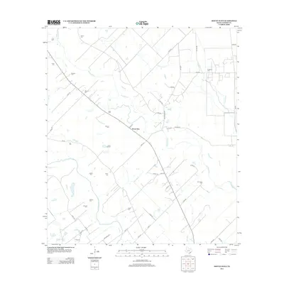
2013 Map of Mount Olive
USGS Topo · Published 2013About this map
Mount Olive stands at a rural crossroads in Jackson County where the coastal prairie meets a network of slow-moving waterways. This landscape is defined by the parallel paths of the Navidad River and the Lavaca River, which flow south across a terrain dotted with family and community legacy sites. The density of small, dispersed burial grounds—including Hines Cem, Chase Cem, and Laughter Cem—points to a long history of local settlement and family landholdings in this corner of Texas.
Find a feature on this map
58 named features on this map. Tap any name to fly to it.
Don’t see what you’re looking for? This feature index may not catch every label — zoom into the map to look around manually.
Map Details
Editions of this 2013 Mount Olive Map
This is the sole edition of this map. No revisions or reprints were ever made.
Other maps of this area

1951 · Inez
USGS Topo · 1:24,000

1952 · Manson
USGS Topo · 1:24,000

1952 · Edna
USGS Topo · 1:24,000

1953 · Beeville
USGS Topo · 1:250,000

1953 · Seguin
USGS Topo · 1:250,000

1956 · Beeville
USGS Topo · 1:250,000

1958 · Seguin
USGS Topo · 1:250,000

1960 · Beeville
USGS Topo · 1:250,000

1963 · Ganado
USGS Topo · 1:24,000

1963 · Mount Olive
USGS Topo · 1:24,000