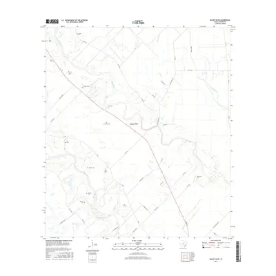
2016 Map of Mount Olive
USGS Topo · Published 2016About this map
Mount Olive sits between two significant Texas waterways, the Navidad River and the Lavaca River, in a landscape defined by ranch roads and family legacies. This area of Jackson County is notable for its exceptional density of small burial grounds, reflecting generations of rural settlement and local genealogy. Numerous named cemeteries, such as Laughter Cem, Enon Cem, and Chase Cem, are scattered across the terrain, often near the winding banks of Sutherland Cr or Milby Br. The road network, including Shady Oaks Rd and Bacon Town Rd, connects these isolated landmarks through the coastal plains. The presence of sites like Burnettville Cem and Wilkerson Cem highlights the scattered nature of community life in this river-bottom country, where private plots and churchyards preserve the names of early resident families.
Find a feature on this map
48 named features on this map. Tap any name to fly to it.
Don’t see what you’re looking for? This feature index may not catch every label — zoom into the map to look around manually.
Map Details
Editions of this 2016 Mount Olive Map
This is the sole edition of this map. No revisions or reprints were ever made.
Other maps of this area

1951 · Inez
USGS Topo · 1:24,000

1952 · Manson
USGS Topo · 1:24,000

1952 · Edna
USGS Topo · 1:24,000

1953 · Beeville
USGS Topo · 1:250,000

1953 · Seguin
USGS Topo · 1:250,000

1956 · Beeville
USGS Topo · 1:250,000

1958 · Seguin
USGS Topo · 1:250,000

1960 · Beeville
USGS Topo · 1:250,000

1963 · Ganado
USGS Topo · 1:24,000

1963 · Mount Olive
USGS Topo · 1:24,000