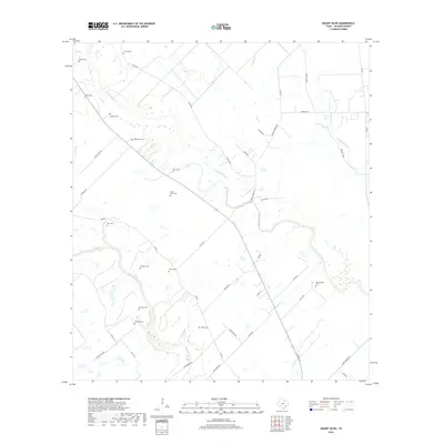
2019 Map of Mount Olive
USGS Topo · Published 2019About this map
The Navidad River and Lavaca River converge in this low-lying coastal plain region of Jackson County, creating a landscape defined by meandering waterways and numerous family burial grounds. The abundance of namesake cemeteries, such as Mount Olive Cem and Burnettville Cem, speaks to a deeply rooted rural settlement pattern where family landholdings were established along the riverbanks. The road network, including Cordele RD and Milby RD, connects isolated homesteads and ranch lands across the drainage basins of Sutherland Cr and Brushy Creek. This modern survey reveals the persistent historical footprint of the area's early residents, with sites like Strane Cem and Laughter Cem preserved amidst the contemporary ranching and agricultural operations of southeast Texas.
Find a feature on this map
46 named features on this map. Tap any name to fly to it.
Don’t see what you’re looking for? This feature index may not catch every label — zoom into the map to look around manually.
Map Details
Editions of this 2019 Mount Olive Map
This is the sole edition of this map. No revisions or reprints were ever made.
Other maps of this area

1951 · Inez
USGS Topo · 1:24,000

1952 · Manson
USGS Topo · 1:24,000

1952 · Edna
USGS Topo · 1:24,000

1953 · Beeville
USGS Topo · 1:250,000

1953 · Seguin
USGS Topo · 1:250,000

1956 · Beeville
USGS Topo · 1:250,000

1958 · Seguin
USGS Topo · 1:250,000

1960 · Beeville
USGS Topo · 1:250,000

1963 · Ganado
USGS Topo · 1:24,000

1963 · Mount Olive
USGS Topo · 1:24,000