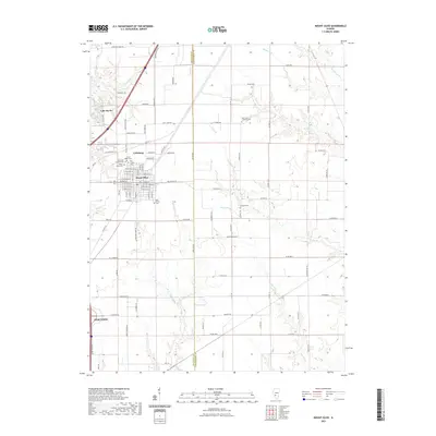
2021 Map of Mount Olive
USGS Topo · Published 2021About this map
Union Miners Cem stands as a significant landmark on the northern edge of Mount Olive, anchoring a cluster of memorial grounds that include Immanuel Lutheran Cem, Cavalry Cem, and Mount Olive Cem. This concentration of cemeteries reflects the shared history and heritage of the community and the nearby settlement of Carlsburg. To the southwest, the edge of Staunton appears along the boundary of Macoupin and Montgomery Counties, where the landscape transitions from the grid of town streets to a rural network of county roads and creek drainages. The area is defined by its water systems, notably the branching of Silver Creek and the presence of Lake Ka-Ho. Rural life is etched into the map through numerous family-named routes such as Grosenheider Rd and Hoefker Rd, alongside landmarks like Heeren Pond and Saint Johns Lutheran Cem.
Find a feature on this map
107 named features on this map. Tap any name to fly to it.
Don’t see what you’re looking for? This feature index may not catch every label — zoom into the map to look around manually.
Map Details
Editions of this 2021 Mount Olive Map
This is the sole edition of this map. No revisions or reprints were ever made.
Other maps of this area

1912 · Gillespie
USGS Topo · 1:62,500

1915 · Gillespie
USGS Topo · 1:62,500

1915 · Mount Olive
USGS Topo · 1:62,500

1927 · Edwardsville
USGS Topo · 1:62,500

1932 · Edwardsville
USGS Topo · 1:62,500

1937 · New Douglas
USGS Topo · 1:48,000

1944 · New Douglas
USGS Topo · 1:62,500

1944 · Mount Olive
USGS Topo · 1:62,500

1954 · Worden
USGS Topo · 1:24,000
1954 · Edwardsville
USGS Topo · 1:62,500