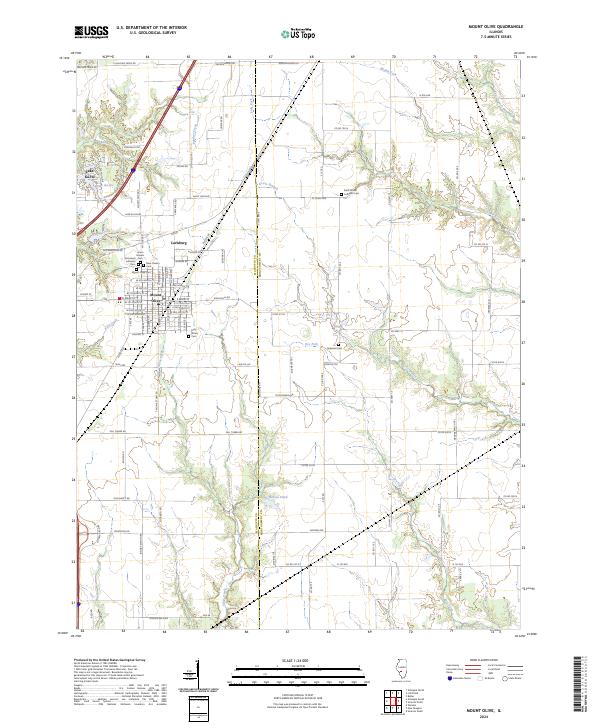
2024 Map of Mount Olive
USGS Topo · Published 2024About this map
Mount Olive serves as the central hub of this modern survey, which sits along the border of Macoupin and Montgomery counties. The landscape is a network of rural roads and watercourses, including Panther Creek and Silver Creek, illustrating the transition from town centers to the surrounding agricultural plains. Local history is deeply etched into the town plan, seen in the density of cemeteries such as Mount Olive Cem, New Calvary Cem, and Holy Trinity Cem. The presence of the Union Miners church reflects the region's labor heritage, while residential pockets like Carlinburg and Lake Ka-Ho show the more recent patterns of community growth around local water bodies like Heeren Pond.
Find a feature on this map
69 named features on this map. Tap any name to fly to it.
Don’t see what you’re looking for? This feature index may not catch every label — zoom into the map to look around manually.
Map Details
Editions of this 2024 Mount Olive Map
This is the sole edition of this map. No revisions or reprints were ever made.
Other maps of this area

1912 · Gillespie
USGS Topo · 1:62,500

1915 · Gillespie
USGS Topo · 1:62,500

1915 · Mount Olive
USGS Topo · 1:62,500

1927 · Edwardsville
USGS Topo · 1:62,500

1932 · Edwardsville
USGS Topo · 1:62,500

1937 · New Douglas
USGS Topo · 1:48,000

1944 · New Douglas
USGS Topo · 1:62,500

1944 · Mount Olive
USGS Topo · 1:62,500

1954 · Worden
USGS Topo · 1:24,000
1954 · Edwardsville
USGS Topo · 1:62,500