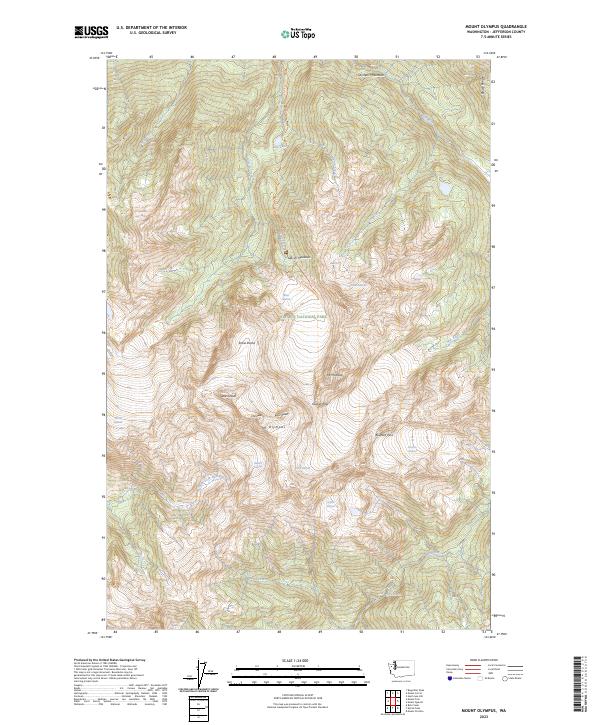
2023 Map of Mount Olympus
USGS Topo · Published 2023About this map
Mt Olympus serves as the focal point of this high-elevation survey within the Olympic National Park and Olympic Wilderness. The landscape is defined by its massive glacial systems, including the Blue Glacier, White Glacier, and Hoh Glacier, which feed the headwaters of the Hoh River and Queets River. The presence of Glacier Meadows and several established backcountry routes like the Hoh River Trail and Blue Glacier Primitive Trail highlights the area's significance for wilderness navigation. Peaks such as West Peak, Mid Peak, and East Peak cluster around the central massif, while smaller water features like Elk Lake and Service Falls dot the lower drainages. This recent data provides a contemporary baseline for tracking the extent of permanent ice fields such as the Ice River Glacier and Humes Glacier in the Olympic Mountains.
Find a feature on this map
38 named features on this map. Tap any name to fly to it.
Don’t see what you’re looking for? This feature index may not catch every label — zoom into the map to look around manually.
Map Details
Editions of this 2023 Mount Olympus Map
This is the sole edition of this map. No revisions or reprints were ever made.
Other maps of this area

1935 · Mount Olympus
USGS Topo · 1:62,500

1939 · Mount Tom
USGS Topo · 1:62,500

1942 · Mount Olympus
USGS Topo · 1:62,500

1947 · Mt Christie
USGS Topo · 1:62,500

1950 · Mt Christie
USGS Topo · 1:62,500

1950 · Hurricane Hill
USGS Topo · 1:24,000
1950 · Bogachiel Peak
USGS Topo · 1:24,000
1950 · Mount Carrie
USGS Topo · 1:24,000

1956 · Mount Olympus
USGS Topo · 1:62,500

1956 · Kloochman Rock
USGS Topo · 1:62,500