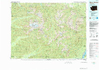
1988 Map of Mount Olympus
USGS Topo · Published 1988About this map
Mount Olympus stands as the central point of this 1988 topographic study, which captures the complex glaciology and drainage systems of the Olympic Peninsula before modern climate shifts significantly altered these alpine features. The map details an intricate network of perennial ice, including White Glacier, Blue Glacier, and the Hoh Glacier, which feed the headwaters of major systems like the Hoh River and Queets River.
Find a feature on this map
83 named features on this map. Tap any name to fly to it.
Don’t see what you’re looking for? This feature index may not catch every label — zoom into the map to look around manually.
Map Details
Editions of this 1988 Mount Olympus Map
This is the sole edition of this map. No revisions or reprints were ever made.
Other maps of this area

1918 · Port Angeles
USGS Topo · 1:62,500

1918 · Lake Crescent
USGS Topo · 1:62,500

1919 · Port Crescent
USGS Topo · 1:62,500

1921 · Quinault Lake
USGS Topo · 1:62,500

1921 · Satsop
USGS Topo · 1:62,500

1922 · Pysht
USGS Topo · 1:62,500

1922 · Lake Crescent
USGS Topo · 1:62,500

1935 · Mount Olympus
USGS Topo · 1:62,500

1936 · Point Misery
USGS Topo · 1:62,500

1938 · Mt Constance
USGS Topo · 1:125,000