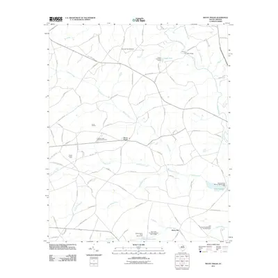
2011 Map of Mount Pisgah
USGS Topo · Published 2011About this map
Mount Pisgah and the settlement at Minton Mill anchor this part of Kershaw County, defined by the winding course of the Lynches River and its numerous tributaries. The landscape is a network of water management and local landmarks, featuring family-named sites such as Raley Millpond and several modern impoundments like Sidney Horton Pond and the Ubanks Pond Dam D-2512. Transportation and recreation are represented by the Bermuda High Gliderport and crossings like Harrisons Ford and Miller Bridge.
Find a feature on this map
88 named features on this map. Tap any name to fly to it.
Don’t see what you’re looking for? This feature index may not catch every label — zoom into the map to look around manually.
Map Details
Editions of this 2011 Mount Pisgah Map
This is the sole edition of this map. No revisions or reprints were ever made.
Other maps of this area

1935 · Camden
USGS Topo · 1:48,000

1938 · Camden
USGS Topo · 1:62,500

1941 · Spartanburg
USGS Topo · 1:250,000

1942 · Camden
USGS Topo · 1:125,000

1953 · Spartanburg
USGS Topo · 1:250,000

1960 · Spartanburg
USGS Topo · 1:250,000

1963 · Spartanburg
USGS Topo · 1:250,000

1964 · Spartanburg
USGS Topo · 1:250,000

1967 · Angelus
USGS Topo · 1:24,000

1967 · Mount Pisgah
USGS Topo · 1:24,000