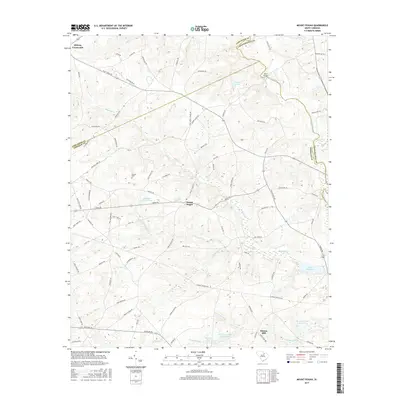
2017 Map of Mount Pisgah
USGS Topo · Published 2017About this map
Mount Pisgah stands as a central point in this rural landscape at the junction of Lancaster, Kershaw, and Chesterfield counties. The settlement is defined by a network of local routes, including Jones Rd and Mount Pisgah Rd, which connect scattered homesteads and family-named landmarks. To the southeast, Minton Mill and Raley Millpond indicate a long history of water-powered industry along the regional drainage basins, while the Lynches River carves the eastern boundary of the quadrangle. Significant for genealogists and local historians, the Stroud Cem is preserved amidst a landscape dominated by timber and agriculture. The terrain is defined by complex creek systems, notably Buffalo Cr and its tributaries Little Buffalo Cr and S Buffalo Cr, which feed several established reservoirs such as Dew Fresh Pond Number One and Horton Pond.
Find a feature on this map
86 named features on this map. Tap any name to fly to it.
Don’t see what you’re looking for? This feature index may not catch every label — zoom into the map to look around manually.
Map Details
Editions of this 2017 Mount Pisgah Map
This is the sole edition of this map. No revisions or reprints were ever made.
Other maps of this area
1935 · Camden
USGS Topo · 1:48,000
1938 · Camden
USGS Topo · 1:62,500
1941 · Spartanburg
USGS Topo · 1:250,000
1942 · Camden
USGS Topo · 1:125,000
1953 · Spartanburg
USGS Topo · 1:250,000
1960 · Spartanburg
USGS Topo · 1:250,000
1963 · Spartanburg
USGS Topo · 1:250,000
1964 · Spartanburg
USGS Topo · 1:250,000
1967 · Angelus
USGS Topo · 1:24,000
1967 · Mount Pisgah
USGS Topo · 1:24,000