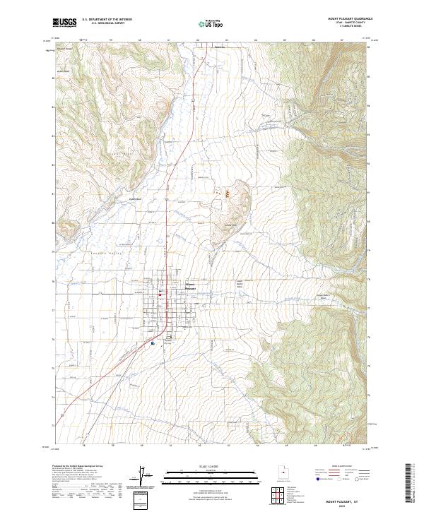
2023 Map of Mount Pleasant
USGS Topo · Published 2023About this map
Mount Pleasant serves as the central hub of this contemporary survey, situated within the fertile Sanpete Valley at the base of the Wasatch Range. The landscape is a complex intersection of natural drainage and human engineering, where the San Pitch River and Birch Creek are augmented by the Moroni and Mount Pleasant Canal and the Sec Ditch. These water management systems reflect the region's agricultural foundations, while newer residential developments like Cedar Hills and those along Cedar Ridge Dr indicate modern expansion into the foothills. The presence of both the Upper Debris Basin and Lower Debris Basin along Pleasant Creek highlights the ongoing geographic management of the mountain runoff. For local historians, the Mount Pleasant City Cem and established routes like Mountainville RD provide clear landmarks for tracing family sites and property boundaries in this part of Sanpete County.
Find a feature on this map
102 named features on this map. Tap any name to fly to it.
Don’t see what you’re looking for? This feature index may not catch every label — zoom into the map to look around manually.
Map Details
Editions of this 2023 Mount Pleasant Map
This is the sole edition of this map. No revisions or reprints were ever made.
Other maps of this area

1885 · Manti
USGS Topo · 1:250,000

1895 · Manti
USGS Topo · 1:250,000

1951 · Moroni
USGS Topo · 1:62,500

1956 · Price
USGS Topo · 1:250,000

1960 · Price
USGS Topo · 1:250,000

1962 · Price
USGS Topo · 1:250,000

1965 · Huntington Reservoir
USGS Topo · 1:24,000

1965 · Fairview Lakes
USGS Topo · 1:24,000

1966 · Spring City
USGS Topo · 1:24,000

1966 · Chester
USGS Topo · 1:24,000