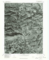
1976 Map of Mount Pocono
USGS Topo · Published 1978About this map
Mount Pocono and its surrounding Monroe County landscape are captured in this orthophotomap, showing the mid-1970s development patterns within the Pocono Mountains. The imagery reveals the concentrated settlement at Tannersville and the emerging infrastructure connecting it to Bartonsville and Reeders. This specific type of survey, produced by the U.S. Geological Survey in cooperation with the Soil Conservation Service, uses rectified aerial photography to provide a literal view of land use that standard topographic maps often abstract. One can see the clearings for residential clusters and the forested tracts between Paradise Valley and Wiscasset, documenting the transition of this region as it grew into a prominent recreation and residential hub.
Find a feature on this map
6 named features on this map. Tap any name to fly to it.
Don’t see what you’re looking for? This feature index may not catch every label — zoom into the map to look around manually.
Map Details
Editions of this 1976 Mount Pocono Map
This is the sole edition of this map. No revisions or reprints were ever made.
Other maps of this area

1891 · Delaware Water Gap
USGS Topo · 1:62,500

1893 · Delaware Water Gap
USGS Topo · 1:62,500

1914 · Wind Gap
USGS Topo · 1:62,500

1916 · Wind Gap
USGS Topo · 1:62,500

1919 · Pocono
USGS Topo · 1:62,500

1921 · Pocono
USGS Topo · 1:62,500

1923 · Pocono
USGS Topo · 1:62,500

1924 · Bushkill
USGS Topo · 1:48,000

1936 · Delaware Water Gap
USGS Topo · 1:48,000

1941 · Delaware Water Gap
USGS Topo · 1:62,500
Featured Places
- Mount Pocono, PA
- Paradise Township, PA
- Bartonsville, Pocono Township
- Pocono Township, PA
- Swiftwater, Pocono Township