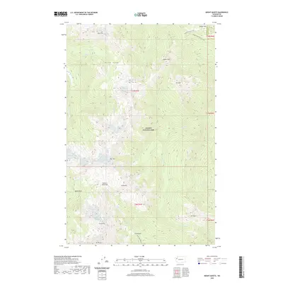
2020 Map of Mount Queets
USGS Topo · Published 2020About this map
Olympic National Park defines this landscape, where the high ridges of the Bailey Range separate several major river headwaters. The drainage patterns here are complex, with the Hoh River flowing to the west, the Goldie River and Queets River cutting through the center, and the Elwha River emerging from the Elwha Basin in the south. This area serves as a primary hydrological hub for the peninsula, fed by features like the Queets Glacier and Cream Lake. High-altitude navigation is represented by primitive routes such as the Dodger Point Primitive Trail and the Ludden Peak Way Trail, which connect prominent summits like Mt Ferry, Mt Scott, and Mt Queets. The presence of Dodwell-Rixon Pass and Bear Pass underscores the difficult passage between these glacial valleys.
Find a feature on this map
34 named features on this map. Tap any name to fly to it.
Don’t see what you’re looking for? This feature index may not catch every label — zoom into the map to look around manually.
Map Details
Editions of this 2020 Mount Queets Map
This is the sole edition of this map. No revisions or reprints were ever made.
Other maps of this area

1935 · Mount Olympus
USGS Topo · 1:62,500

1938 · Mt Constance
USGS Topo · 1:125,000

1942 · Mount Olympus
USGS Topo · 1:62,500

1944 · Mt. Angeles
USGS Topo · 1:62,500

1946 · Mt. Angeles
USGS Topo · 1:62,500

1947 · Mt. Steel
USGS Topo · 1:62,500

1947 · Mt Christie
USGS Topo · 1:62,500

1950 · Mt Christie
USGS Topo · 1:62,500

1950 · Mt. Steel
USGS Topo · 1:62,500

1950 · Hurricane Hill
USGS Topo · 1:24,000