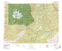
1978 Map of Mount Rainier
USGS Topo · Published 1978About this map
Mount Rainier dominates this 1978 topographic study, its glacial system radiating across the Mount Rainier National Park boundary toward the surrounding wilderness. The map captures the rugged interior of the southern Cascades during a period of established federal management, showcasing the vast Gifford Pinchot National Forest and Snoqualmie National Forest lands. Settlement is concentrated in the river valleys to the south and east, notably at Packwood and Randle along the Cowlitz River, where the Packwood Landing Strip suggests the importance of air access in this isolated terrain.
Find a feature on this map
50 named features on this map. Tap any name to fly to it.
Don’t see what you’re looking for? This feature index may not catch every label — zoom into the map to look around manually.
Map Details
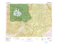
Editions of this 1978 Mount Rainier Map
2 editions found
Other maps of this area

1897 · Mount Stuart
USGS Topo · 1:125,000

1897 · Tacoma
USGS Topo · 1:125,000

1899 · Ellensburg
USGS Topo · 1:125,000

1900 · Tacoma
USGS Topo · 1:125,000

1901 · Ellensburg
USGS Topo · 1:125,000

1901 · Snoqualmie Pass
USGS Topo · 1:125,000

1902 · Mount Aix
USGS Topo · 1:125,000

1902 · Mount Stuart
USGS Topo · 1:125,000

1903 · Snoqualmie
USGS Topo · 1:125,000

1904 · Mt Aix
USGS Topo · 1:125,000