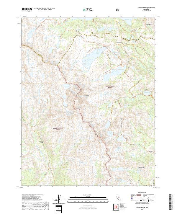
2021 Map of Mount Ritter
USGS Topo · Published 2021About this map
Sierra Nevada high country defines this landscape at the intersection of the Inyo National Forest and Sierra National Forest. The map centers on the formidable Ritter Range, where glaciers and granite basins hold iconic water bodies like Thousand Island Lake, Garnet Lake, and Ediza Lake. Steep topographical gradients lead toward the jagged spires of the Minarets and the towering summits of Mt Ritter and Banner Peak.
Find a feature on this map
82 named features on this map. Tap any name to fly to it.
Don’t see what you’re looking for? This feature index may not catch every label — zoom into the map to look around manually.
Map Details
Editions of this 2021 Mount Ritter Map
This is the sole edition of this map. No revisions or reprints were ever made.
Other maps of this area

1901 · Mt. Lyell
USGS Topo · 1:125,000

1947 · Mariposa
USGS Topo · 1:250,000

1948 · Mariposa
USGS Topo · 1:250,000

1953 · Merced Peak
USGS Topo · 1:62,500

1953 · Mono Craters
USGS Topo · 1:62,500

1953 · Devils Postpile
USGS Topo · 1:62,500

1956 · Tuolumne Meadows
USGS Topo · 1:62,500

1957 · Mariposa
USGS Topo · 1:250,000

1963 · Mariposa
USGS Topo · 1:250,000
1976 · Yosemite Valley
USGS Topo · 1:100,000