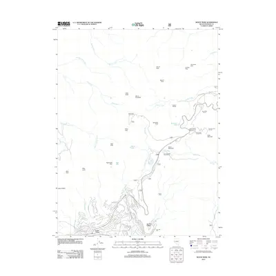
2012 Map of Mount Rose
USGS Topo · Published 2012About this map
Incline Village sits at the base of the Carson Range on this 2012 study, revealing the complex road network and recreational development of the northern Lake Tahoe region. High-altitude landmarks like Mount Rose and Mount Rose Summit dominate the landscape, surrounded by winter sport infrastructure including the Mount Rose Ski Area, Slide Mountain Ski Area, and Incline Ski Area. The map details residential enclaves such as Tyrolian Village, where streets like Fairview Blvd and Country Club Dr wind toward the Incline Golf Course.
Find a feature on this map
74 named features on this map. Tap any name to fly to it.
Don’t see what you’re looking for? This feature index may not catch every label — zoom into the map to look around manually.
Map Details
Editions of this 2012 Mount Rose Map
This is the sole edition of this map. No revisions or reprints were ever made.
Other maps of this area

1891 · Carson
USGS Topo · 1:125,000

1891 · Truckee
USGS Topo · 1:125,000

1893 · Carson
USGS Topo · 1:125,000

1893 · Truckee
USGS Topo · 1:125,000

1895 · Truckee
USGS Topo · 1:125,000

1932 · Truckee
USGS Topo · 1:96,000

1940 · Truckee
USGS Topo · 1:125,000

1950 · Mt. Rose
USGS Topo · 1:62,500

1952 · Mt. Rose
USGS Topo · 1:62,500
1955 · Kings Beach
USGS Topo · 1:24,000