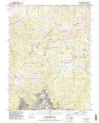
1992 Map of Mount Rose
USGS Topo · Published 1994About this map
Incline Village serves as the residential anchor for this high-altitude landscape, featuring a detailed street grid including Northwood Blvd and Fairview Dr. The settlement is closely integrated with educational and recreational landmarks like Sierra Nevada College, Incline High Sch, and the nearby Diamond Peak Ski Resort. This 1992 revision highlights the area's transition into a premier alpine destination, balanced between developed residential pockets and the expansive Mount Rose Wilderness.
Find a feature on this map
61 named features on this map. Tap any name to fly to it.
Don’t see what you’re looking for? This feature index may not catch every label — zoom into the map to look around manually.
Map Details
Editions of this 1992 Mount Rose Map
This is the sole edition of this map. No revisions or reprints were ever made.
Other maps of this area

1891 · Carson
USGS Topo · 1:125,000

1891 · Truckee
USGS Topo · 1:125,000

1893 · Carson
USGS Topo · 1:125,000

1893 · Truckee
USGS Topo · 1:125,000

1895 · Truckee
USGS Topo · 1:125,000

1932 · Truckee
USGS Topo · 1:96,000

1940 · Truckee
USGS Topo · 1:125,000

1950 · Mt. Rose
USGS Topo · 1:62,500

1952 · Mt. Rose
USGS Topo · 1:62,500
1955 · Kings Beach
USGS Topo · 1:24,000