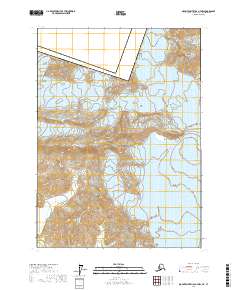
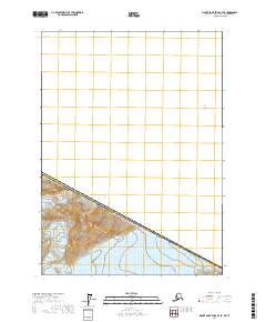
2017 Map of Mount Saint Elias A-7 NW
USGS Topo · Published 2017About this map
Wrangell-Saint Elias National Park dominates this high-latitude terrain where the international border meets the massive ice fields of the northern Pacific coast. This 2017 survey details the dramatic transition from the high peaks of the Saint Elias Mountains down through a series of colossal ice flows. The immense Malaspina Glacier and Agassiz Glacier are mapped alongside the Augusta Glacier, illustrating the complex glacial drainage patterns that define this landscape. A critical geopolitical marker, Boundary Peak 184, sits directly on the line between United States of America and Canada, positioned near the Yakutat Borough. The topography reveals the isolation of the Samovar Hills and the narrow passage at Dome Pass, offering a precise record of these shifting ice masses and remote mountain features during the early twenty-first century.
Find a feature on this map
18 named features on this map. Tap any name to fly to it.
Don’t see what you’re looking for? This feature index may not catch every label — zoom into the map to look around manually.
Map Details
Editions of this 2017 Mount Saint Elias A-7 NW Map
This is the sole edition of this map. No revisions or reprints were ever made.
Other maps of this area

1951 · Mt Saint Elias
USGS Topo · 1:250,000

1959 · Mt Saint Elias
USGS Topo · 1:250,000
1985 · Mount Saint Elias A-7
USGS Topo · 1:63,360
1985 · Mount Saint Elias B-7
USGS Topo · 1:63,360
1985 · Mount Saint Elias A-8
USGS Topo · 1:63,360
1985 · Mount Saint Elias B-8
USGS Topo · 1:63,360
2017 · Mount Saint Elias A-7 SW
USGS Topo · 1:25,000
2017 · Mount Saint Elias B-7 SW
USGS Topo · 1:25,000
2017 · Mount Saint Elias A-8 NE
USGS Topo · 1:25,000
2017 · Mount Saint Elias B-7 SE
USGS Topo · 1:25,000