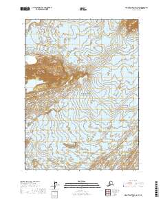
2017 Map of Mount Saint Elias A-8 SW
USGS Topo · Published 2017About this map
Wrangell-Saint Elias National Park defines this landscape, where massive ice fields and isolated rock formations dominate the coastal Alaskan wilderness. The expansive Agassiz Glacier flows through the center of the quadrangle, flanked to the west by the Chaix Hills and the prominent Moore Nunatak. This terrain is representative of the active glacial environment near the Gulf of Alaska, showing the intersection of heavy glaciation and rugged topography. The southern edge of the map reveals the massive reach of the Malaspina Glacier, providing a detailed look at the drainage patterns and ice-marginal features of one of North America's largest piedmont glaciers during the early twenty-first century.
Find a feature on this map
9 named features on this map. Tap any name to fly to it.
Don’t see what you’re looking for? This feature index may not catch every label — zoom into the map to look around manually.
Map Details
Editions of this 2017 Mount Saint Elias A-8 SW Map
This is the sole edition of this map. No revisions or reprints were ever made.
Other maps of this area

1950 · Bering Glacier
USGS Topo · 1:250,000

1950 · Icy Bay
USGS Topo · 1:250,000

1951 · Icy Bay
USGS Topo · 1:250,000

1951 · Bering Glacier
USGS Topo · 1:250,000

1951 · Yakutat
USGS Topo · 1:250,000

1951 · Mt Saint Elias
USGS Topo · 1:250,000

1959 · Yakutat
USGS Topo · 1:250,000

1959 · Bering Glacier
USGS Topo · 1:250,000

1959 · Mt Saint Elias
USGS Topo · 1:250,000

1961 · Icy Bay
USGS Topo · 1:250,000