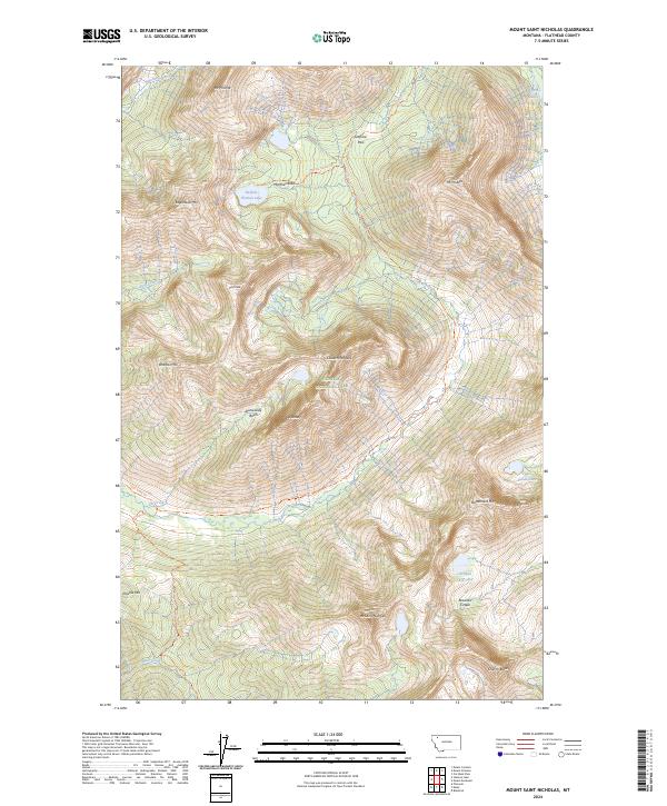
2024 Map of Mount Saint Nicholas
USGS Topo · Published 2024About this map
Glacier National Park dominates this high-altitude landscape, centered on the dramatic horn of Mt Saint Nicholas. The terrain is defined by extreme elevation changes and glacial landforms, including the deep bowl of Rotunda Cirque and the high waters of Buffalo Woman Lake. This modern digital survey documents a primitive wilderness area where travel is limited to established paths like the Coal Creek Trl and Fielding Trl. The map illustrates the hydrological patterns of the Continental Divide's western slopes, with headwaters such as Pinchot Creek and Muir Creek carving through narrow basins. Peaks like Mt Phillips and Wolftail Mtn stand as significant landmarks for backcountry navigation, while Marthas Basin provides a rare level opening among the steep ridges.
Find a feature on this map
34 named features on this map. Tap any name to fly to it.
Don’t see what you’re looking for? This feature index may not catch every label — zoom into the map to look around manually.
Map Details
Editions of this 2024 Mount Saint Nicholas Map
This is the sole edition of this map. No revisions or reprints were ever made.
Other maps of this area

1901 · Browning
USGS Topo · 1:125,000

1903 · Browning
USGS Topo · 1:125,000

1904 · Chief Mountain
USGS Topo · 1:125,000

1913 · Marias Pass
USGS Topo · 1:125,000

1914 · Nyack
USGS Topo · 1:125,000

1938 · Chief Mountain
USGS Topo · 1:125,000

1960 · Cut Bank
USGS Topo · 1:250,000

1963 · Cut Bank
USGS Topo · 1:250,000

1964 · Cut Bank
USGS Topo · 1:250,000

1964 · Essex
USGS Topo · 1:24,000