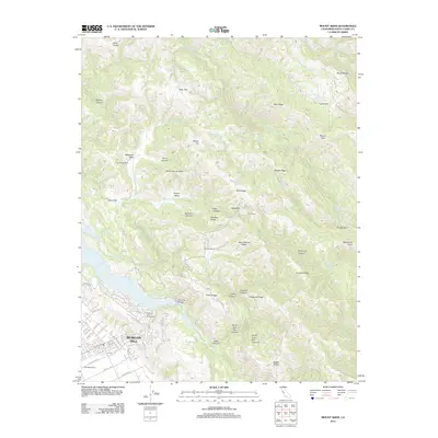
2012 Map of Mount Sizer
USGS Topo · Published 2012About this map
Anderson Lake and the winding course of Coyote Cr define the southwestern landscape of this Santa Clara County region. Residential development is clustered near the shore along Jackson Oaks Dr and Oakridge Rd, where the Holiday Lake Golf Course and Cochrane Bridge provide community landmarks. To the south, the Pedrizetti Winery marks a local agricultural tradition near the intersection of San Pedro Ave and Tennant Ave.
Find a feature on this map
72 named features on this map. Tap any name to fly to it.
Don’t see what you’re looking for? This feature index may not catch every label — zoom into the map to look around manually.
Map Details
Editions of this 2012 Mount Sizer Map
This is the sole edition of this map. No revisions or reprints were ever made.
Other maps of this area

1897 · Mt. Hamilton
USGS Topo · 1:62,500

1917 · Morgan Hill
USGS Topo · 1:62,500

1921 · Gilroy Hot Springs
USGS Topo · 1:62,500

1938 · Mt. Boardman
USGS Topo · 1:62,500

1939 · Morgan Hill
USGS Topo · 1:62,500

1939 · Gilroy Hot Springs
USGS Topo · 1:62,500

1940 · Gilroy Hot Springs
USGS Topo · 1:62,500

1941 · Morgan Hill
USGS Topo · 1:62,500

1942 · Mt. Hamilton
USGS Topo · 1:62,500

1942 · Mt. Boardman
USGS Topo · 1:62,500