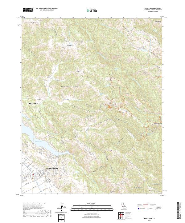
2021 Map of Mount Sizer
USGS Topo · Published 2021About this map
Mt Sizer and the high ridges of the Diablo Range define this landscape east of the Santa Clara Valley. The terrain is characterized by a dense network of canyons and ridges, including Soda Springs Canyon and Schoolhouse Ridge, which fall away toward the significant water storage of Anderson Lake in the southwest. The presence of Madrone Soda Springs and numerous springs like Blackberry Spring and Deer Horn Spring suggests a hydrogeology that once supported local retreats and early settlements in these uplands. Historically named flats like Sizer Flat, Poverty Flat, and Cold Flat indicate areas where the steep topography relented enough for human activity. On the western edge, the map shows the modern expansion of Morgan Hill and San Jose reaching toward the foothills, where suburban streets like Barrett Ave and E Dunne Ave meet the open spaces of Packwood Valley.
Find a feature on this map
109 named features on this map. Tap any name to fly to it.
Don’t see what you’re looking for? This feature index may not catch every label — zoom into the map to look around manually.
Map Details
Editions of this 2021 Mount Sizer Map
This is the sole edition of this map. No revisions or reprints were ever made.
Other maps of this area

1897 · Mt. Hamilton
USGS Topo · 1:62,500

1917 · Morgan Hill
USGS Topo · 1:62,500

1921 · Gilroy Hot Springs
USGS Topo · 1:62,500

1938 · Mt. Boardman
USGS Topo · 1:62,500

1939 · Morgan Hill
USGS Topo · 1:62,500

1939 · Gilroy Hot Springs
USGS Topo · 1:62,500

1940 · Gilroy Hot Springs
USGS Topo · 1:62,500

1941 · Morgan Hill
USGS Topo · 1:62,500

1942 · Mt. Hamilton
USGS Topo · 1:62,500

1942 · Mt. Boardman
USGS Topo · 1:62,500