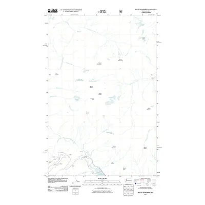
2011 Map of Mount Skokomish
USGS Topo · Published 2011About this map
Staircase and the North Fork Skokomish River serve as the primary landmarks in this 2011 survey of the Olympic Peninsula high country. The map illustrates a landscape defined by deep glaciated valleys and sharp peaks, where modern recreational infrastructure like Staircase Campground sits alongside vestiges of earlier mountain industry such as the Darky Mine near Camp Pleasant. The elevation changes are dramatic, climbing from the northern reach of Lake Cushman to the high summits of Mount Skokomish, Mount Cruiser, and Mount Stone. Notable water bodies including Flapjack Lakes and Mildred Lakes are nestled below the jagged Sawtooth Ridge, while the Hamma Hamma River drains the eastern slopes toward the Sound. The presence of remote outposts like Nine Stream Camp underscores the area's character as a gateway for backcountry navigation and historic surveying.
Find a feature on this map
44 named features on this map. Tap any name to fly to it.
Don’t see what you’re looking for? This feature index may not catch every label — zoom into the map to look around manually.
Map Details
Editions of this 2011 Mount Skokomish Map
This is the sole edition of this map. No revisions or reprints were ever made.
Other maps of this area

1938 · Mt Constance
USGS Topo · 1:125,000

1943 · Potlatch
USGS Topo · 1:62,500

1947 · The Brothers
USGS Topo · 1:62,500

1947 · Mt. Steel
USGS Topo · 1:62,500

1950 · The Brothers
USGS Topo · 1:62,500

1950 · Mt. Steel
USGS Topo · 1:62,500

1952 · Potlatch
USGS Topo · 1:62,500

1953 · Mt Tebo
USGS Topo · 1:62,500

1958 · Seattle
USGS Topo · 1:250,000

1962 · Seattle
USGS Topo · 1:250,000